
Featured Projects
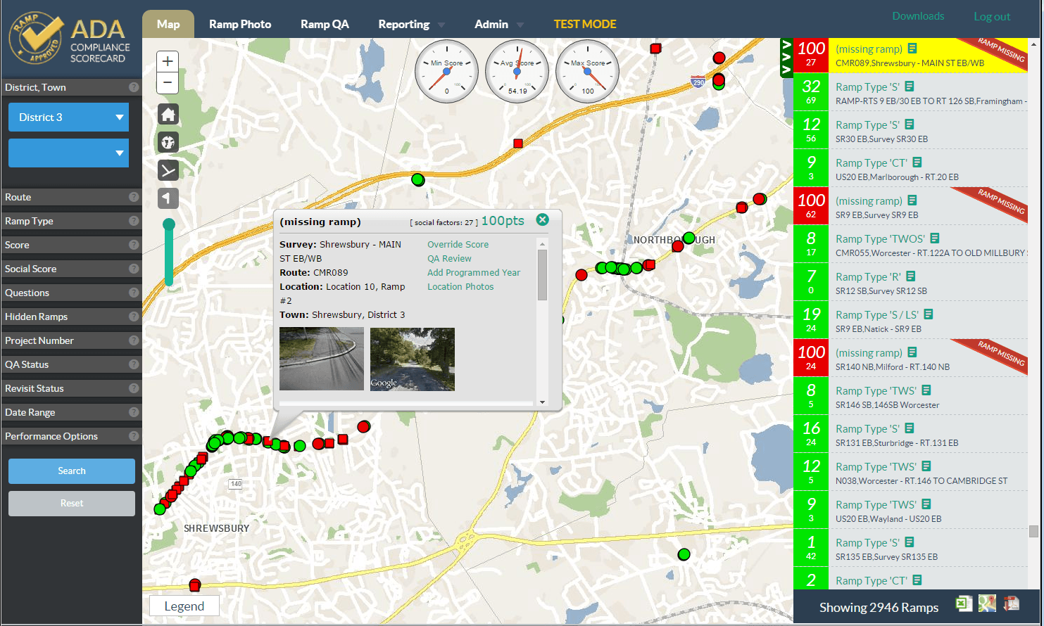


ADA Compliance and Curb Ramp Survey System
- Along with our sister company, BSC Group, Geonetics was engaged by MassDOT to design and build a full stack, mobile field data collection system to support the inventory of curb ramps throughout the Commonwealth. To date, data has been collected on over 8000 miles of jurisdictional roads and at over 30,000 ramp locations. The system included a custom, android tablet application integrated with ArcGIS Server for maps and with a custom cloud based application server to process and store data from multiple field crews.
MBTA Land Tracker
Geonetics is under contract to provide a next generation HTML5 based real estate land management solution for the MBTA. The system features an easy to use interface that directly integrates multiple data streams for various databases. Other features of the system include:
- ArcGIS Server Mapping Integration
- Custom Document Management
- Financial System Integration
- Custom ArcGIS Desktop Extension for Data Management
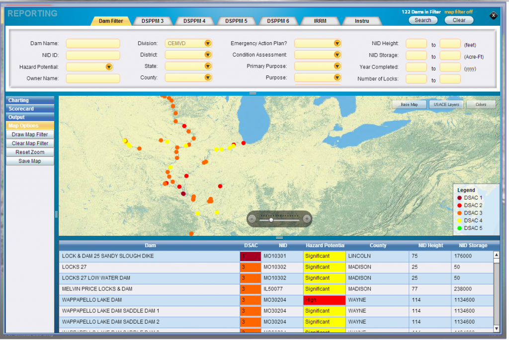
National Inventory of Dams
Geonetics has completed the design, development, and deployment of a system to manage the information submitted by all States and many Federal agencies to maintain a comprehensive inventory of dams nation-wide. Because each State and Agency manages their own inventory independently, a system that would map and reconcile data fields and codes consistent with the target central database was required. Other features of the system include:
- Integrated mapping
- Custom Spreadsheet Parsing
- Saving and storing of user based parsing and matching rules
- Easy-to- use user interface for non-technical users
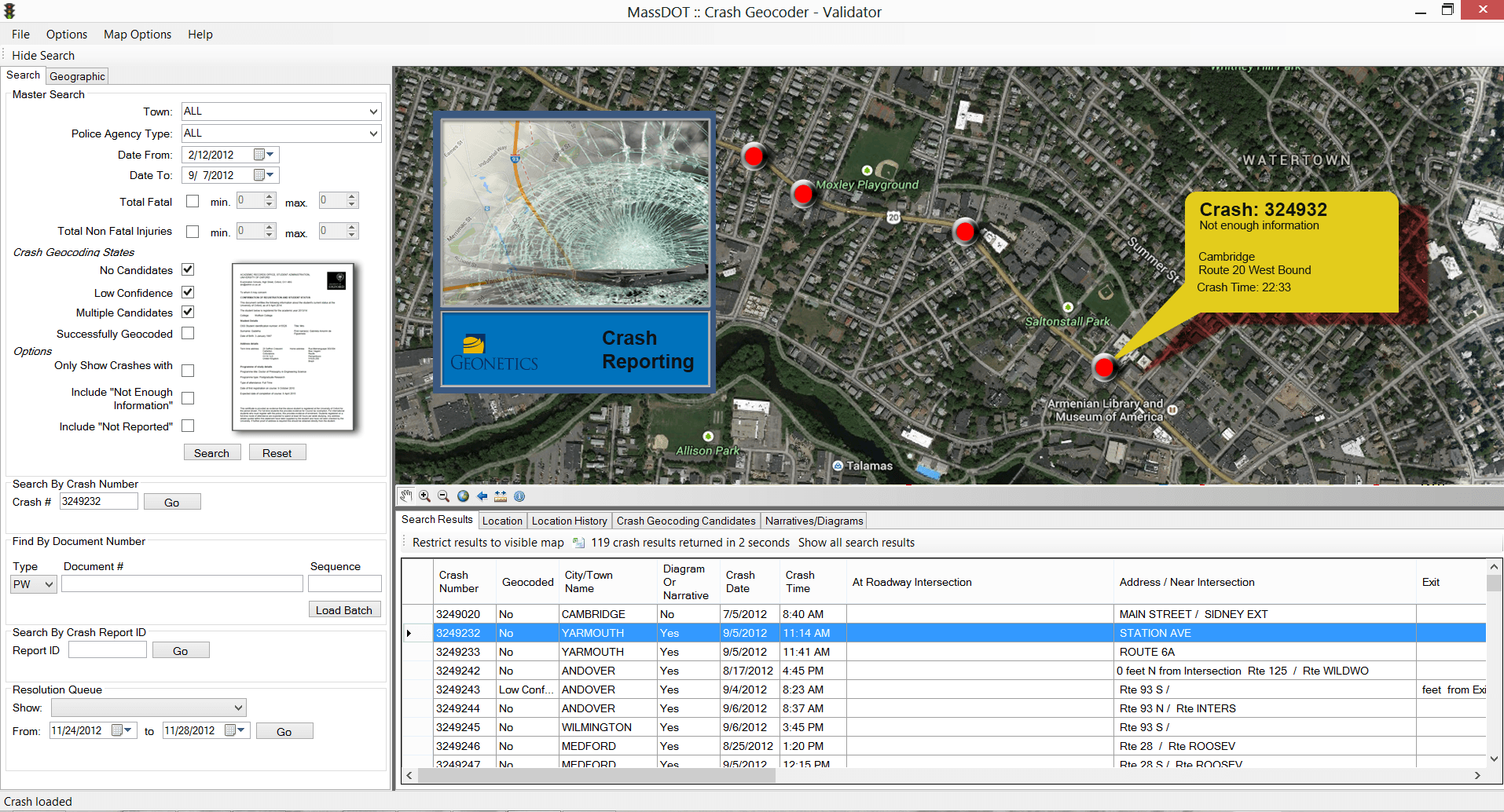
Crash Data Validation System
Designed and developed a custom user interface for automated and semi-automated resolution of crash locations from operator and police automobile crash reports. This custom solution integrated with the client's GIS and linear referencing solution and provide standardized validation of crashes that could not be located to a point on a map.